After I'd heard they were coming to Pittsburgh to film The Road, I could immediately see where they could do some filming. So, being an underemployed movie fan with a camera, I drove around the region, took pictures and submitted them to the local production office.
I never did hear anything back, so I'll just share them with you. Consider this page neither news nor rumor but something akin to commentary.
My Proposal
I'm a big fan of The Road, that dark, post-apocalyptic novel set in an unknown year in America a few years after an uncertain catastrophe. The characters have to worry about global winter rather than global warming. After years of eeking out an existence in a small town somewhere in the southeast, a man takes his small son on a journey to the ocean and hoped-for safety. Along the way, they have to struggle against, the weather, starvation, bad people and tortured people who seem to be on the menu for bands of cannibals. While the movie follows the physical journey of these two, it also follows an important inner journey -- can the father instruct his son in what it means to be a good human being when a society of good human beings no longer exists?
I took all of these photos (except for one where noted) on Sunday, February 3, 2008. It was an uncharacteristically sunny day. Western Pennsylvania tends to be cloudy and dreary during the fall, winter and spring. All locations were easily accessible from local roads.
 |
|
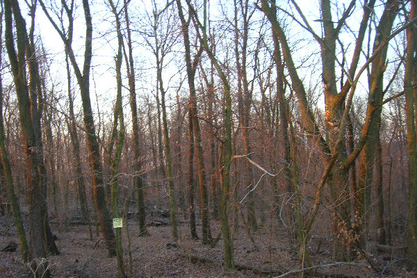
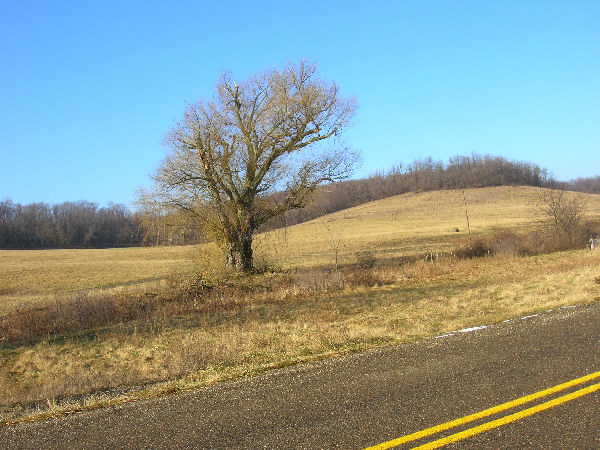
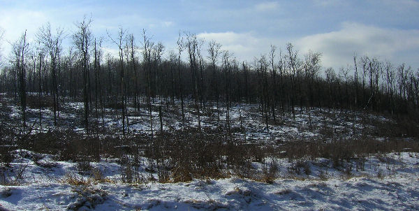
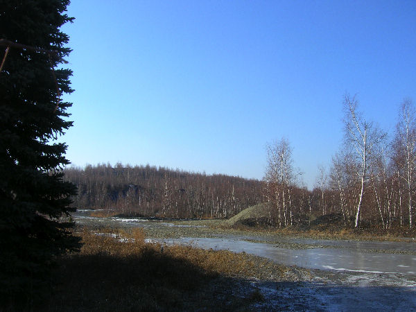
| Book: Page 3, Woods | Location: Off Commodore Dr., North Fayette Township [[Commodore is a quiet road, south of Route 22 and the Pittsburgh airport about 20 miles west of downtown Pittsburgh]] |
 |
|
| Location: Off Commodore Dr., North Fayette Township , PA, |
|
 |
|
| Location: Off Commodore Dr., North Fayette Township |
|
 |
|
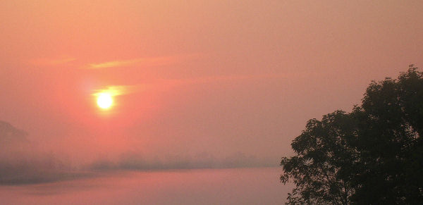
| Book: Page 4, Sunrise, Valley | Location: Off Commodore Dr., North Fayette Township The valley is often foggy in the morning. Taken in summer, 07 |
 |
|
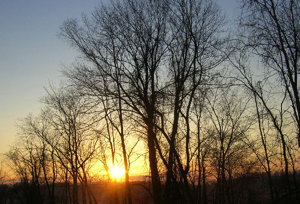
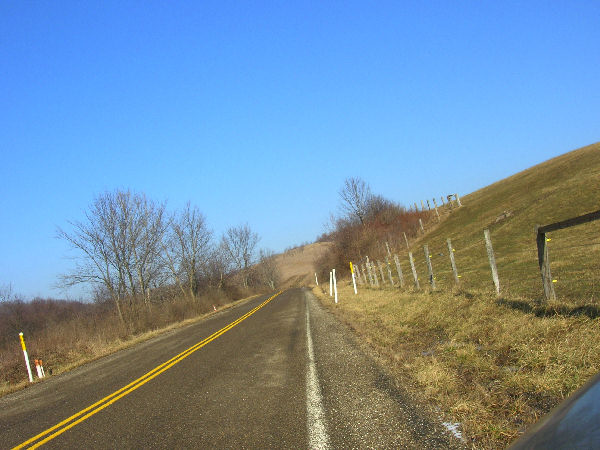
| Book: Page 6 | Location: Seabright Rd., North Fayette Township, PA [[Seabright is a very quiet road, south of Route 22 and the Pittsburgh airport about 23 miles west of downtown Pittsburgh]] |
 |
|
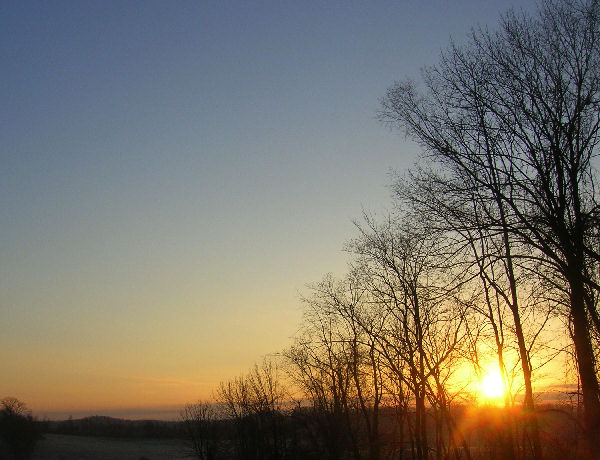
| Book: Page 6 | Location:Seabright Rd., North Fayette Township, PA |
 |
|
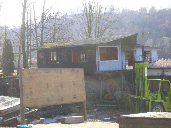
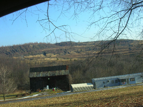
| Book: Page 6 - burned out garage | Location:Marina on Cheat Lake, West Virginia [[1 1/2 hours SE of Pittsburgh. This is on the east side of Cheat Lake, off of Route 68. This is near Mont Chateau State Park. This might be more visually interesting than the gas station.]] |
 |
|
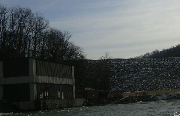
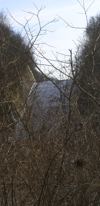
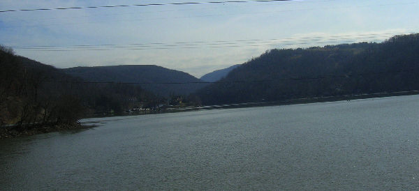
| Book: Page 19 - the dam | Location: Youghiogheny Dam, Confluence PA [[About 2 hours east of Pittsburgh; an hour north of Cheat Lake West Virginia.]] |
 |
|
| Book: Page 19 | Location: Youghiogheny Dam, Confluence PA [[This is a state park area and there's lots of interesting nooks and crannies here; it's pronounced "Yockagainy"]] |
 |
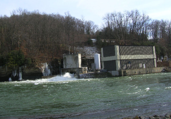
Book: Page 19 Location: Youghiogheny Dam Spillway, Confluence PA |
 |
|
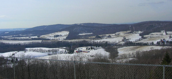
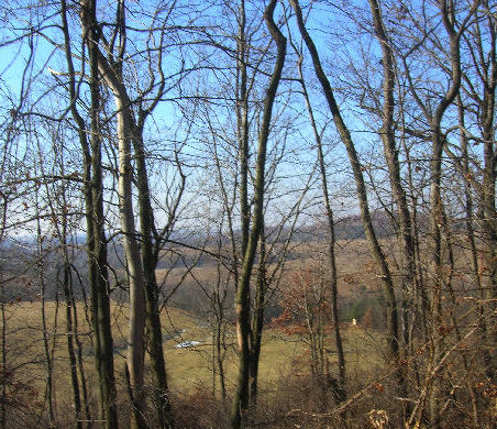
| Book: Page 21, Valley | Location: Maryland, just off of Route 68, Exit 14, Route 219 South |
 |
|
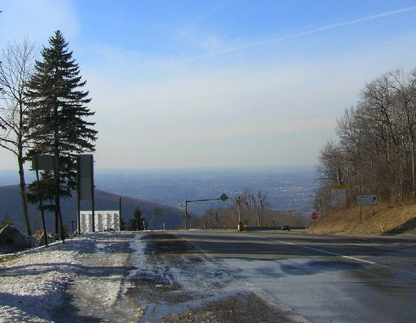
| Book: Page 33, climbing the mountain | Location: Summit of Route 40, near Laurel
Caverns, looking northwest Route 40 is an old 2-lane highway, steep in places; it would be an interesting place to film but has truck traffic. |
 |
|
| Book: Page 33, climbing pass | Location: Another possibility is around Keyser Pass,
Route 68, near exit 14, West Virginia, about two hours from
Pittsburgh It's a modern highway. All these areas tend to be
foggy. This area lost 1/2 its trees in a tornado in 1998 |
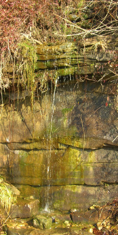 |
Book: Page 38 - waterfall Location: Next to Cheat Lake Iron Bridge, West Virginia. |
 |
|
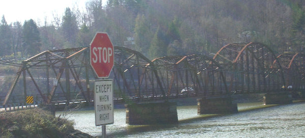
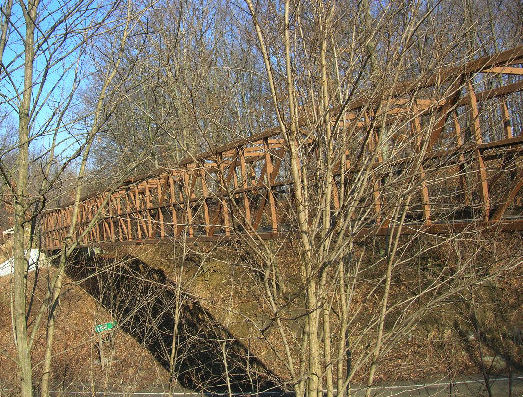
| Book: Page 43 - bridge | Location: Old Iron Bridge over Cheat Lake, West Virginia |
 |
|
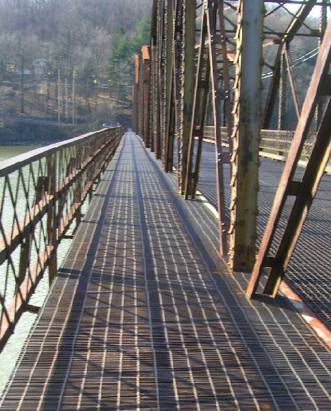
| Book: Page 43 | Location: Old Iron Bridge over Cheat Lake, West Virginia |
 |
|
| Book: Page 43 | Location: View from Old Iron Bridge over Cheat Lake, West Virginia, looking south |
 |
|
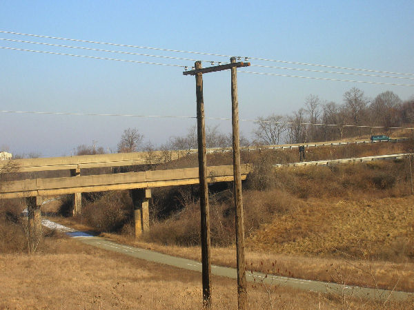
| Book: Page 85 | Location: Near Quicksilver Golf Course, Montour Trail Entrance, Robinson (Washington County), 25 miles SW of Pittsburgh |
 |
|
| Book: Page 86, crossroads | Location: Route 22, and the Montour Trail taken from Route 980, about 22 miles west of Pittsburgh |
 |
|
| Book: Page 116 | Location: Just off Potato Garden Run, Boggs and Bussy, Montour Trail, near the Imperial landfill about 24 miles west of Pittsburgh in Findlay |
 |
|
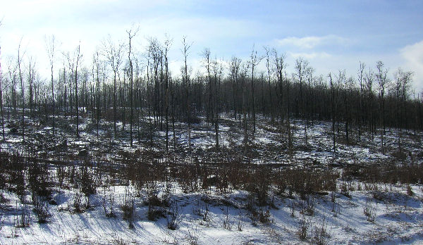
| Book: Sections where the characters slog through gray, barren areas | Location: Beech Hollow Fly Ash area is so large it shows up as a gray pit in Google Earth. It's closed to the public, so I couldn't get too close it. Here's a shot from about a mile away looking east. This is about 28 miles west of Pittsburgh. |
 |
|
| Book: "Slogging through gray ash" | Location: This is Beech Hollow looking west, taken from route 980, about 24 miles west of Pittsburgh |
 |
|
| Book: Scene where many trees have blown down | Location: Keyser Pass, Route 68, near exit
14, West Virginia, about two hours from Pittsburgh.
Speculation: The "money shot," the scene where the father and son see just how badly parts of the countryside have been devastated, will probably be filmed outside of Mt. St. Helens. When you visit that area, you drive through the woods for a few miles. Suddenly, you emerge into a big gray nothing (at least it was like that in 1990; I know there's been some tree regrowth since then). However, shooting an "establishment shot" in an area like Keyser Pass that shows partial tree damage, could set things up for the lead characters to see a more completely destroyed area. |
 |
|
| General woods/fields shot | From Seabright, near the 980 and Route 22, about 24 miles west of Pittsburgh. |
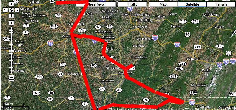
| I made essentially the following drive on 2/3/07 (Pittsburgh itself would be a little bit above the "Street View" button). The furthest point from Pittsburgh was the Keyser Pass area, which is under 2 1/2 hours to the southeast. | |
 |
|
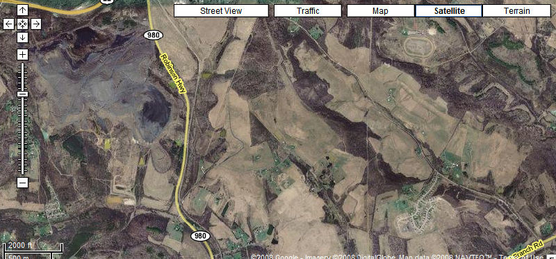
| Here's a "close-up" map of the area about 20 miles west of Pittsburgh. Route 22 intersects at the top left of the map. The photographs were taken along Route 980, along Seabright and just off of Commodore: | |
 |
|
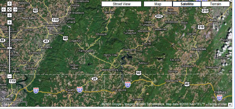
| Finally, here's roughly were the photos were taken in West Virginia, Maryland, and the Laurel Highlands of Southern Pennsylvania: | |
 |
|